Wild Wales Challenge
Sunday 25th August 2013
Entry Fee: £15
Event HQ: Bala Sports Pavilion, Bala, Gwynedd
Distance: 81.4 miles
Link to my ride on Strava
For a short summary of the event, have a look at this lovely Storify, collated by Scarlet Fire
Bwlch Goriwared. Probably not a name with which you are familiar. A google search will tell you where it is but reveals little else. I’ve also seen it called Pen y Feidiog, but there’s very few references out there to that name either. To be fair they aren’t the catchiest names nor is it in the most fashionable location.
Bwlch y Groes is the well-known name among local mountain road passes, by virtue of being 14 metres higher above sea level and the fact that it used to be a regular feature in the Milk Race / Tour of Britain. The carmakers who used it as a testing ground in the early 20th century nicknamed it “Hellfire Pass”. Many claim it is the highest stretch of tarmac in Wales, though the Gospel Pass in the Black Mountains further south may in fact edge this accolade (Wikipedia says so anyway). Both of these are well-known names to British cyclists, often featuring on “Best Climb” lists along with the likes of Hardknott, Bealach na Ba, Cat and Fiddle and of course Ditchling Beacon and Box Hill, included to placate soft southerners and make them feel like they can climb too.

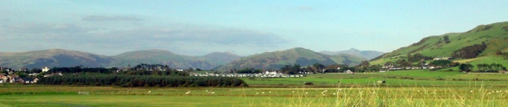
There may be a debate over the highest road in Wales, but I’m confident in claiming that Bwlch Goriwared is the 3rd highest, at 531m it edges Bwlch yr Afan, near Treorchy. To climb it from the east side, the only way up is from Llanuwchllyn, the village at the opposite end of Llyn Tegid (Bala Lake) from the town of Bala. From the west side, you have 3 choices. From Coed-y-Brenin, via Pont Abergeirw; from the A470 at Trawsfynydd; or from the A470 at Bronaber, past Trawsfynydd Holiday Village. These 3 roads all meet at a junction on the hillside above the holiday village, at about 325m above sea level. Already pretty high, and already looking quite bleak. This is not a route for bad weather. Take the road signed Llanuwchllyn, which immediately drops downhill to the tune of about 75m. Harsh, Bwlch Goriwared, very harsh.
Not as harsh as Merseyside CTC, organisers of the Wild Wales Challenge. This annual event is based in Bala, using a different route each year to showcase the best lanes, toughest climbs, and trickiest descents that this wild part of the country has to offer. This was my first time on the event, but I heard a few regulars commenting that they had “gone easy” on us this year by omitting Bwlch y Groes from the route. I didn’t hear this opinion mentioned at the finish line. By taking us from just a few metres above sea level, by the Maentwrog Hydro Power Station on the Dwyryd Estuary, at 93km, up to the 531m summit of Bwlch Goriwared at 114km, they had pretty much defined the expression “sting in the tail”. A height gain of 515m over 21km of riding would be tough if it was simply a steady climb all the way, however with a few downhill sections thrown in, we actually climbed over 820m (2700ft) on this stretch of the route. Harsh indeed.
Of course, the ride is supposed to be a “Challenge”, so nobody was expecting the organisers to make it easy. This is not one of those events where every junction is adorned with a bright reassuring signpost or a friendly high-viz wearing steward. Entrants are asked to study the provided route description carefully. A production line of tea and Mr Kipling features at the control points, where other events would be handing out sponsor-provided energy bars and sports drink powders. Sadly the bacon barm seller that was expected to be present at the start area proved to be a no-show.
Prior to that hardcore 21km I described above, we did get some respite from the climbing. For about 14km we rolled around the relative flatlands of the towns of Tremadog and Porthmadog, over “The Cob”, through Minffordd and Penrhyndeudraeth villages, over the Penrhyndeudraeth Toll Bridge (no charge for cycles!) and along the Dwyryd Estuary to the power station.
Various pubs and cafes in Tremadog and Porthmadog had experienced a sudden rush of hungry and thirsty cyclists, on top of the usual busy Bank Holiday weekend trade. We enjoyed a refreshing pint of local brew Purple Moose in Tremadog, accompanied by snacks from the Spar opposite after a harrassed individual appeared from the pub kitchen and shouted “45 minutes for food”.

Getting through Porthmadog was a “back to modern traffic” culture shock after the virtually empty lanes we had enjoyed throughout the morning, but we soon left that behind again as we headed across the Cob. This is a Victorian embankment that carries the Ffestiniog Railway and the main road across the Glaslyn Estuary. Until last year this relatively narrow road would not have been a pleasant place to cycle. Now a new bypass has taken through traffic away from the Cob it is a real pleasure with panoramic views inland of Snowdon, Cnicht (“The Welsh Matterhorn”) and the Moelwyn mountains. We were blessed with a sunny and extremely clear day to show off this majestic landscape to the full.
The morning had provided a contrast to the afternoon. Not because it was flat, oh no. While the afternoon gave us a flattish warm up to shake off the cafe legs, followed by what was effectively one long, steady climb, the morning featured a relentless (I heard this word a lot) series of steep, narrow, twisty climbs, alternated with a series of equally steep, narrow, twisty descents.
The local authorities (Conwy and Gwynedd councils) seemed to have had a recent blitz of resurfacing the minor mountain roads in the area. You might see this as a good thing, and in the longer term it certainly will be. Unfortunately they never seem to finish the job properly by sweeping up all the loose chippings once the surface has had a chance to bed in. This leaves 2 possible car-tyre-width lines which give rear-wheel traction on the climbs, and the same 2 lines where you can be confident of not washing out the front wheel on the descents. The local livestock had made their own slippery additions to the surface too.
The highest point of the morning, after warming the legs up with a few ups and downs, was on the Migneint, a desolate area of high moorland, the source of the Conwy and Tryweryn rivers among others. The climb up to the 482m summit from the hamlet of Carrog near Penmachno was perhaps the toughest of the day, gaining 306m in altitude over just 3.4km, an average grade of almost 9%. The rewards for this effort were fantastic views of the Rhinog mountains and some distant glimpses of Tremadog Bay, tantalising us with the prospect of lunch. This also led to the only real “balls-out” descent of the day, with good sight lines on the initial narrow minor road section leading onto a couple of wider, well-surfaced B-roads sweeping us down to the first control point in Llan Ffestiniog.
I’d seen pictures of the queues at the control points in previous years, and worried that this could be a frustrating part of the day. In practise though the electronic scanning system worked very well, as did the volunteers handing out the refreshments, and the delay was minimal. There was an impressive array of different club jerseys on display, mostly from North Wales, North-West England and the West Midlands. Plenty of generic non-club jerseys and surprisigly few pro-team replicas. Maybe these got left in the wardrobe after the recent spate of “Do pro-team jerseys make you look like a knob?” articles in both the cycling and mainstream press. Or maybe it’s indicative of a lack of correlation between the type of person entering this event and the type of person who wears those jerseys. The fella in the Sky-branded rainbow jersey I clocked walking on the first climb of the day does deserve a special mention here I think.
After that it was just a case of getting over the climb from the Oakeley Arms up to Rhyd (2.6km at 5.4%, the first 600m of which average 11.1%), and the climb from the Glaslyn valley at Prenteg up to Cwm Ystradlyn (2.4km at 9.5% with some very steep hairpins), before finally dropping into Tremadog and trying not to neck the Purple Moose too quickly.

The long final descent down to Llanuwchllyn from the summit of Bwlch Goriwared proved just as exhilarating as any that had gone before. Some of those steep twisty bits with the loose chippings, some fast, shallower stretches with more open bends, and even some short climbs to get you out of the saddle once more. With fatigue starting to creep in after the day’s exertions, it was vital to maintain concentration.
From here we had 10 rolling km along the “back” shore (ie the opposite shore to the main A494 road) of the lake to the finish in Bala. I’d already exceeded my previous longest ride of the year, and probably done the most climbing I’ve ever done in a day (quite possibly in a week!), so before the ride I had expected this last stretch to be a struggle. In the event, though, I was feeling surprisingly fresh (repeated 80 – 90km+ commuting days have served me well), so I decided that with no more climbs to save energy for I might as well get the head down and really push it to the finish. Even if I did completely blow up I knew I would be able to limp home somehow.
I love rolling roads like this when my form is good, and this one is a real cracker – not too narrow, with a reasonable surface, light traffic and some great views across the lake. Wind up the speed and you can push on in a big gear over any of the lumps that it throws at you. A great finish to the day and a decent “warm down” for the legs after all that climbing.
One final scan of the electric tag, one more cup of tea and bit of Mr Kipling, before taking ownership of my commemorative slate plaque and retiring to the nearby White Lion for another couple of pints of recovery drink, accompanied by some of McCoys own sports nutritional products.

In my preview post, I set out some rough time targets, which I met pretty comfortably, but said that my main target was getting round without walking any of the hills. Did I meet this? Well, not quite. I ended up walking 3 short sections. Once I spun out on chippings, just managed to keep going, then pulled a foot out of a cleat. Another time I simply didn’t have the breath to ask a couple with lower gears than my 42-26 to give me a gap to pass them. And once it was just simply too unrelentingly flipping steep and I ground to a halt.
I highly recommend this event. If you’re one of those riders that “doesn’t like hills” then pencil it in now and start practising some climbing. Get round this and you’ll never complain about another hill again! And if you’re one of those riders who actually seek out hills you will absolutely love this ride.

